Annie's Geoscience Journey
  • Home
  • My story
  • Contact
  • PhD Footprint
  • 北歐博士申請
Sign in Subscribe

Remote Sensing

Playing with fire: A beginner's guide to fire data

Playing with fire: A beginner's guide to fire data

(This post is also published on Landscape Detectives: Critical Physical Geography at Lund University) 
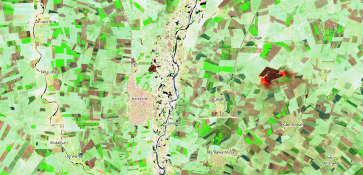
Climate change and its impacts are making pyrogeography a hot topic. To monitor wildfire in a remote area, or to understand fire regime in regional or global scale, we need reliable fire data for better fire
Annie Lin Jan 29, 2026
What is remote sensing? What is the capability of remote sensing in environmental issues?

What is remote sensing? What is the capability of remote sensing in environmental issues?

Remote sensing is the acquisition of data from a distance, and it has become widely used in multiple sectors, including individuals, research institutes, environmental organizations, the military, and governments across the world. According to the Fortune Business Insight, the global remote sensing satellite market is valued at USD 14.11
Annie Lin Jun 8, 2024

Subscribe to Annie's Geoscience Journey

Don't miss out on the latest news. Sign up now to get access to the library of members-only articles.
  • Sign up
Annie's Geoscience Journey © 2026. Powered by Ghost